
Walk a Mount Pleasant Street
A sound street directory search separates five facts that often get blended together: the postal address, the legal municipality, the parcel, the assessed owner, and evidence of occupancy. USPS can standardize the mailing label, while Racine County and Village GIS identify the parcel and municipal boundary. AssessorData supplies the tax-key route and assessed-property fields. A deed can connect named parties to the legal tract, but it does not prove that either party lived there. MyVote is an individual match tool, not a public block roster. Historical directories can name a householder for a selected year, though rural Mount Pleasant coverage is uneven.
- Normalize the address with USPS, while preserving the spelling that was first supplied.
- Search AssessorData, selecting Racine County and Village of Mount Pleasant, then save the tax key and legal description.
- Open the Racine County GIS viewer and click parcels along the same block to confirm boundaries and road context.
- Use the current and prior owner names, tax key, legal description, and a date range in the Register of Deeds index.
- For a dated occupancy clue, consult MyVote for an individual match or a directory volume for the right year. Never turn either source into a private-address roster.
This chain supports different kinds of conclusions. The parcel card reports assessment facts; the deed establishes a recorded transfer; a directory gives a dated listing. Keep those claims separate. For a whole named-road workflow after the address is resolved, remain with the parcel and deed sequence rather than shifting into a one-person search.
Mount Pleasant Address Search Fields
AssessorData supports an address route and an alternate tax-key route. A search miss may reflect a new address, the wrong municipality, or a key-format issue. The portal's help warns that an address created after the annual January 1 assessment date may not appear until values are final. The public card can provide a field model, but the assessor remains the controlling local source.
| Control | Input | How to use it | Limit |
|---|---|---|---|
| County | Dropdown | Select Racine | Required |
| Municipality | Dropdown | Select Village of Mount Pleasant | Separates the Village from a Racine postal label |
| Property street address | Text | Try the normalized form, then omit St. or Ave. | One search route |
| Tax key number | Text | Use the parcel key as an alternate | Format varies |
| Parcel result | Selection | Open card, tax, GIS, and document links | Available after a match |
A result may show tax key, property and mailing addresses, abbreviated legal description, acreage, building facts, last permit and sale dates, assessed land and improvements, total value, and assessment year. These are assessment fields, not proof of title or residence.
The captured AssessorData search shows the official address and tax-key entry route:
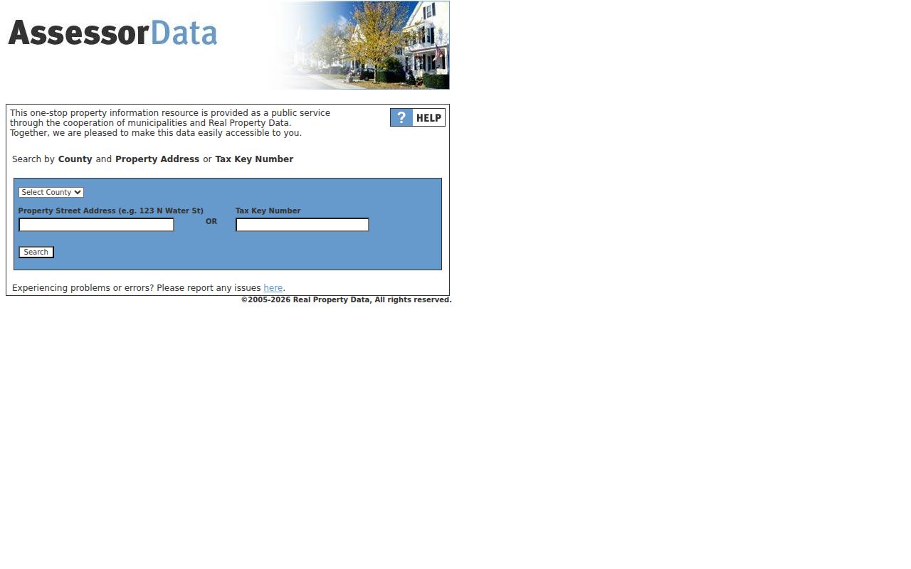
Choose the Village municipality before trusting the match, especially when the mailing city is Racine.
Mount Pleasant's 151 Parcel Key
The first three digits of a Racine County parcel key identify the municipality. Mount Pleasant uses 151. That makes the full 15-digit tax key a useful bridge when the mailing city says Racine, the local government is the Village, or an older record uses town language. Some county tax screens ask for the final 12 digits without dashes, so preserve both the full key and the exact input form.
- Parcel
- A mapped unit of land used by tax and land-record systems.
- Situs address
- The physical property address, which may differ from the tax-bill mailing address.
- Plat
- A recorded map of lots, blocks, streets, or a survey division.
- Criss-cross directory
- A dated directory arranged by address or street rather than only by surname.
The key helps join records, but it does not erase source limits. A GIS line is approximate. A recorded survey or deed controls legal rights, and the Register of Deeds does not conduct a title search for visitors.
Note: Save the legal description with the parcel key because address spelling and postal city can change while the tract description provides continuity.
Map Mount Pleasant Parcels by Street
The Village GIS site and county viewer let a researcher center on an address, click the parcel, and browse along the road. Useful layers include tax parcels, municipal boundaries, zoning, conditional-use context, right-of-way information, and 2024 imagery. The county DocInfo route can add parcel dimensions and subdivision or right-of-way document leads.
Use the map to see geographic relationships, not to draw a legal boundary. Zoning labels such as neighborhood residential or low-density residential describe the map layer, not a permit or entitlement. Imagery records visible conditions on its capture date; it does not identify an owner or resident.
The captured county parcel viewer shows the map-based starting point:
After selecting a parcel, carry its tax key into the tax and recorded-document systems rather than relying on the shape alone.
Mount Pleasant Street Record Coverage
Several official sources accept an address, parcel, or street-related identifier. Together they form a practical Mount Pleasant street directory, yet each answers a narrow question. Keep that street directory tied to source dates and parcel keys. Online access is only one channel. When a portal fails, use the assessor appointment route, public Register of Deeds computers, the Village records form, or an archive request.
| Record Set | Keeper | What It Shows | Access |
|---|---|---|---|
| Property and tax roll | Village Assessor and Racine County | Assessed owner, situs, mailing field, values | Free portal or assessor appointment |
| GIS parcel map | Village and Racine County GIS | Parcels, municipality, zoning, ROW, imagery | Free viewer and DocInfo links |
| Recorded deeds | Racine County Register of Deeds | Grantor, grantee, legal tract, recorded date | Free index, paid image or office copy |
| Voter information | Wisconsin Elections Commission | Individual registration match and activity | MyVote; no public block roster |
| Permits and project files | Village Planning, Building, Engineering | Address, work type, status, dates, public attachments | BS&A account or records request |
| Historic directories | UW-Parkside and Racine Public Library | Dated householder, business, or rural listing | Online, archive, or appointment route |
The tax key and legal description join the parcel roll to recorded instruments. The street spelling joins permits and dated directories. No single source establishes every person at a home, so describe the precise record instead of calling a name a confirmed resident.
Deeds Along Mount Pleasant Streets
The LandShark occasional-user guide says online images and tract indexing extend from 1989 forward. Index and tract searches are free. Image access costs $2 for the first page and $1 for each later page, while card use carries a $5 convenience charge and a grantor/grantee search is $5. Older material may require public computers, tract cards, deed books, or staff help.
Search current owner, prior owner, grantor, grantee, document type, parcel or legal description, and a bounded date. A grantor transfers an interest; a grantee receives it. Record the document number, instrument type, dates, legal description, book and page when present, return address, and image count. LandShark warns that the working index can contain errors and that older scans may be hard to read.
The Racine County Register of Deeds at 730 Wisconsin Avenue offers public computers first-come, generally from 8:30 a.m. to 4:00 p.m. Staff will not perform a title search. Known-document copies cost $2 for the first page and $1 for each additional page, with $1 added for certification. Call 262-636-3208 to confirm current access.
Mount Pleasant's Postal Address Quirk
A Mount Pleasant parcel may use Racine as its preferred postal city. Wisconsin's official ZIP and city table recognizes Mount Pleasant or Mt Pleasant with several Racine-area ZIP entries, including 53404, 53405, and 53406. The Village's 2025 ZIP-resolution packet says at least five ZIP codes affect Village and nearby properties. Neither fact assigns every parcel to a ZIP.
Use USPS ZIP Code Lookup for the mailing result and GIS for the legal municipality. Record both. This distinction prevents a Mount Pleasant street directory search from excluding a Village parcel simply because the postal label says Racine.
Do not merge the labels. A postal city guides mail, while the municipal boundary decides which local government and parcel jurisdiction apply.
Mount Pleasant Permits and ROW
Village permit and inspection records can show an address, work type, permit number, status, dates, inspections, applicant or contractor fields when public, and attachments. The Applications and Permits route uses a current BS&A account. If the attachment is not online, ask Planning, Building, or Engineering for the exact address, record type, and date range.
Right-of-way is another address clue. The Village ROW page cautions that public right-of-way may extend about 10 to 20 feet beyond the curb. That is useful road context, but exact rights come from recorded instruments. A curb, lawn edge, or GIS line is not a survey.
A permit proves that an application or inspection record exists. It does not by itself establish completion, title, or occupancy. Current road projects may explain a changed street view, but do not claim a renamed road without an official action or recorded plat.
Older Mount Pleasant Street Listings
No verified official street-renumbering year was found for Mount Pleasant. When a modern number fails, omit the suffix, try an earlier spelling, search the post office or township name, and bridge the result with the parcel's legal description. Before Village incorporation in September 2003, many records appear under town or township labels.
UW-Parkside and Racine Public Library hold selected city, area, and farmers' directories. A reverse or criss-cross volume can turn an address into a dated householder or business listing, while a farmers' directory may identify a rural owner by section, post office, and acreage. Coverage is not continuous and may favor the City of Racine. The full shelf belongs on the Mount Pleasant city directories page.
Search without “St.” or “Ave.” first. Then preserve the year, page, publisher, exact spelling, and whether the volume is city, area, rural, township, or farmer-oriented. A directory entry is dated evidence, not a claim about who is there now.
Request Missing Mount Pleasant Records
The Village public-record request form asks for a reasonable subject and time period. Give the department, record category, exact address or parcel key, date range, and preferred electronic delivery. Wisconsin Public Records Law, Wis. Stat. §§19.31–19.39, does not impose one fixed response deadline; the response must come as soon as practicable and without delay.
For a permit, request the named project or file. For a deed, contact the Register of Deeds rather than the Village. For a police incident, the separate police form accepts the subject, incident location, report number, incident date, and delivery choice. Black-and-white police copies are listed at $0.25 per page, and prepayment may be required when an estimate exceeds $5.
Keep the request wording, date, custodian, acknowledgment, fee estimate, redactions, and returned filename. A focused street record request is easier to locate than a demand for every record tied to an address.
Limits of Mount Pleasant Street Records
A property card names the assessed owner, not every person who lives at the address. Renters and household members are not reliably indexed through parcel systems. Utility customer lists are not a normal public directory, and motor-vehicle address data is restricted under the federal Driver's Privacy Protection Act. MyVote withholds date of birth, license and Social Security fields, confidential-elector addresses, and accommodation indicators under Wis. Stat. §6.36.
Safe at Home may replace an eligible participant's actual address with an assigned address. Do not try to reverse it. A missing address or field can reflect a legal safeguard, a source-coverage gap, or an input mismatch. It is not proof that a person has never lived on the street.
Lawful use. Use Mount Pleasant address records for lawful personal research. Wisconsin law prohibits stalking and harassment; never use a street directory to intimidate, track, or harm someone.
Official records also change. Confirm a material fact with the office that keeps the record, note the access date, and publish no more personal detail than the task requires.