
Sources Around Mount Pleasant Neighbors
A block search should begin with place, not identity. County and Village maps show parcel relationships, boundaries, roads, zoning context, and imagery. Assessment records add public parcel fields. USPS settles the mailing format. Permit and project files can explain visible work. MyVote can match an individual who uses the official tool, but it offers no public “all voters on this block” screen. Community groups publish meeting routes and public contacts, not a complete block roster.
| Source | What It Shows About a Block | Access |
|---|---|---|
| County and Village GIS | Parcels, tax keys, boundaries, zoning, ROW, imagery, adjacent map context | Public viewers; click one parcel at a time |
| Assessor and tax inquiry | Assessed owner, property and mailing fields, value context | Public search; not a household list |
| Village permits and projects | Address-keyed work, inspection, road, or project context | BS&A route or focused request |
| USPS | Postal city and ZIP normalization | Address-by-address lookup |
| MyVote | Individual registration and activity match | Name/DOB or address; no public block roster |
| Historic directories and plats | Dated occupants, businesses, owners, and road geography | RPL, UW-Parkside, and archive sources |
| Lakeside civic groups | Public meeting and community-policing contact points | Published civic route; no member roster |
An assessed owner may live elsewhere, and a mailing address can differ from the property address. A parcel record says nothing complete about renters, relatives, or other household members. Phrase every conclusion at the level the source supports.
Map a Mount Pleasant Block
The official materials document address and parcel search plus ordinary map browsing. They do not document a buffer or radius tool. A reproducible neighbor search therefore centers on one known address, identifies that parcel, and pans across the lots that touch or face it. Save each public-source link and note the map date.
- Normalize the address through USPS, while keeping postal city distinct from legal municipality.
- Find the parcel in Racine County GIS or the Village GIS viewer.
- Click adjoining and facing parcels one at a time. Record tax key, municipality, road relation, zoning context, and source URL.
- Check the assessment record only for public parcel facts. Do not infer occupancy from an owner or mailing field.
- Switch to the full Mount Pleasant street directory only when the task expands beyond the immediate block.
Map lines are not surveys. Zoning labels are planning context, not decisions or permits. Right-of-way can also extend beyond the curb, so a visual lawn edge does not settle ownership or public access.
The captured Mount Pleasant GIS portal is the practical map entry point:
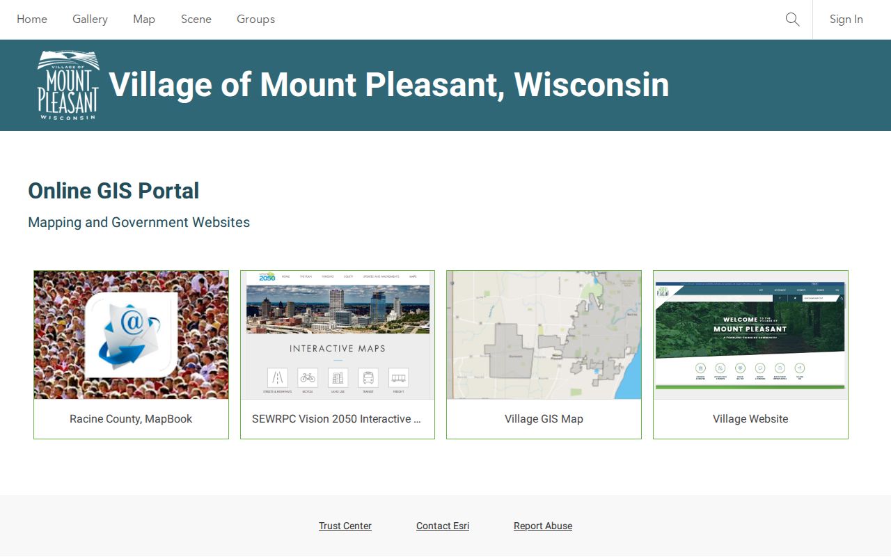
Use the viewer to understand nearby parcels, then verify any important fact in the assessor, permit file, or recorded instrument.
Postal Neighbors, Legal Boundaries
Mount Pleasant properties can carry a Racine postal label. Wisconsin's official ZIP table recognizes Mount Pleasant or Mt Pleasant as an acceptable city name with several Racine-area rows, while the Village's 2025 resolution packet says at least five ZIP codes affect Village and nearby properties. Postal geography and municipal geography are different systems.
Use USPS ZIP Code Lookup for the preferred mailing city and ZIP+4, then GIS for the municipality and parcel. A home across the road may share a postal city yet sit in a different local jurisdiction. Mount Pleasant is framed by Lake Michigan to the east, Caledonia to the north, Yorkville to the west, and Somers or Kenosha County to the south.
Note: A Racine mailing label does not prove that an address is inside the City of Racine or outside Mount Pleasant.
Mount Pleasant Civic Neighbor Contacts
No consolidated official Village-wide neighborhood-association directory was found. The most specific public civic route is the Lakeside Area Neighborhood Watch, which lists monthly meetings at the Lakeside COP House. The Village describes the COP House's community-policing history. Deer Creek Estates provides a private HOA example, but its information is private-site material rather than a Village roster.
Lakeside Area Neighborhood Watch
Public monthly meeting and contact route at 2237 Mead Street. See Racine Neighborhood Watch. No public member directory was located.
Village Lakeside COP House
The Village history page explains the community-policing setting. It is public facility information, not a resident database.
Deer Creek Estates HOA
The private association page may provide current governance contacts. Verify currency and do not treat it as a public membership roll.
A public meeting offers a safe way to learn about local issues without compiling private addresses. Association boundaries, board roles, and contacts can change, so rely on the group's current notice.
Mount Pleasant Voter Record Limits
Wisconsin MyVote has a name mode requiring first name, last name, and date of birth, plus an address mode requiring street, unit when needed, city, and ZIP. A match can show registration information, elections voted, officials, polling tools, and absentee options. The public interface is designed for an individual match, not discovery of a whole block.
Wis. Stat. §6.36 withholds date of birth, driver's-license and Social Security data, confidential-elector address, and an accommodation indication from the public list. A no-match can result from spelling, punctuation, date format, old data, or confidential treatment. Wisconsin does not register voters by party, and election participation never reveals ballot choices.
A lawful question about the statewide or jurisdictional voter file belongs with the Wisconsin Elections Commission. Do not scrape MyVote or republish its matches as a block directory.
Official Mount Pleasant Sources Compared
Official rolls and commercial neighbor tools answer different questions. The official source names its keeper, scope, and access channel. A commercial compilation may merge parcel, marketing, address-history, and filing data without a clear date. It can be stale or attach one person's details to another.
| Quality | Official source | Commercial compilation |
|---|---|---|
| Provenance | Named agency or archive | Often assembled from several feeds |
| Meaning | Defined parcel, permit, filing, or registration field | May blend ownership, contact, and history |
| Correction | Custodian or agency process | Provider-specific process |
| Best use | Source-qualified civic, property, or family research | Unverified lead only |
No compiled tool can override Safe at Home, driver privacy, voter protections, sealed court records, or other lawful restrictions. Confirm facts with the record keeper.
Earlier Mount Pleasant Neighbors
Historic directories, plat maps, tax rolls, newspapers, and archive collections can describe an earlier block. UW-Parkside's 1873 Racine and Kenosha plat exhibit supplies township and owner context, while Racine Public Library holds local directories, newspapers, maps, photos, yearbooks, and vertical files. Rural Mount Pleasant may be missing from a city volume or listed by post office, section, or farm.
Racine Heritage Museum's surname-card file can point to newspaper articles, cemetery markers, 1858 plat entries, and naturalization material. The card is a finding aid, not proof of a current address. Confirm its source citation and then locate the underlying item.
A dated directory occupant, a plat owner, and a current parcel owner may all be different. Record year, collection, page or box, and repository. That makes neighborhood change visible without pretending that an old name identifies today's household.
Mount Pleasant Shared Street Space
Road projects and right-of-way records provide useful block context. Village materials warn that the public right-of-way can extend roughly 10 to 20 feet beyond the curb. The precise right comes from the recorded document, not from the visible pavement, lawn edge, or an approximate GIS line.
Permit and engineering files can identify a project address, work type, inspection, status, and public attachment. Ask for the road or project name, address or intersection, department, and a bounded period. A focused Village records request is the fallback when an item is absent from the online archive.
Construction notices explain why access or the street view changed. They do not show who lives nearby. Keep infrastructure facts apart from resident assumptions.
Privacy for Mount Pleasant Neighbors
Private block facts include renters, household members, utility customers, delivery details, unlisted contacts, and confidential-elector addresses. A parcel owner, ZIP, deed, or tax card does not reveal all people at an address. Safe at Home provides an assigned address and mail forwarding for eligible participants; the actual location is not a puzzle to solve.
Wisconsin Public Records Law uses a strong access policy, yet custodians still apply confidentiality laws and a public-interest balancing test. They may redact or withhold protected details. A missing field may reflect a lawful safeguard rather than a broken search.
Lawful use. Research Mount Pleasant neighbors for civic context, family history, or personal safety. Never use records to watch, threaten, intimidate, stalk, or harass another person.
Use the least personal detail needed. Preserve citations privately, confirm important findings with the custodian, and avoid publishing a list of owner names merely because the map makes them accessible.